
This is an extended version of an article that appeared in the latest edition of the “Weaverham News”.
(Expanded views below.)
In this issue we look at our River Weaver. Some residents in Sandy Lane and Acton Bridge will not feel well disposed to our river presently but it can’t be wished away. Weaverham and Sutton Weaver near Frodsham are the only places named for the river, surprisingly.

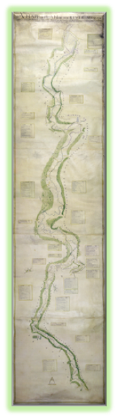
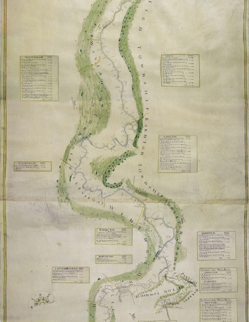
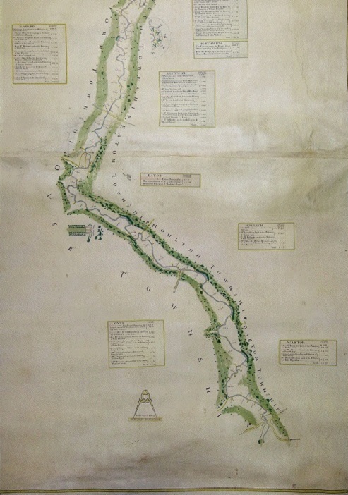
The River Weaver is Cheshire’s longest river. It rises at Peckforton near Beeston then meanders across the Cheshire plain in a big loop, becoming navigable at Winsford and from there it is “canalised” before passing Weaverham and then joining the Mersey at Weston near Runcorn. Before being straightened the river was much more meandering as can be seen on the map . The map was drawn in 1721, so 300 years ago.
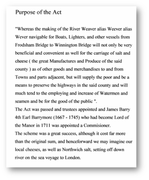
An Act of Parliament was required to allow for the river channel to be straightened and below is an extract and comment on its effect:
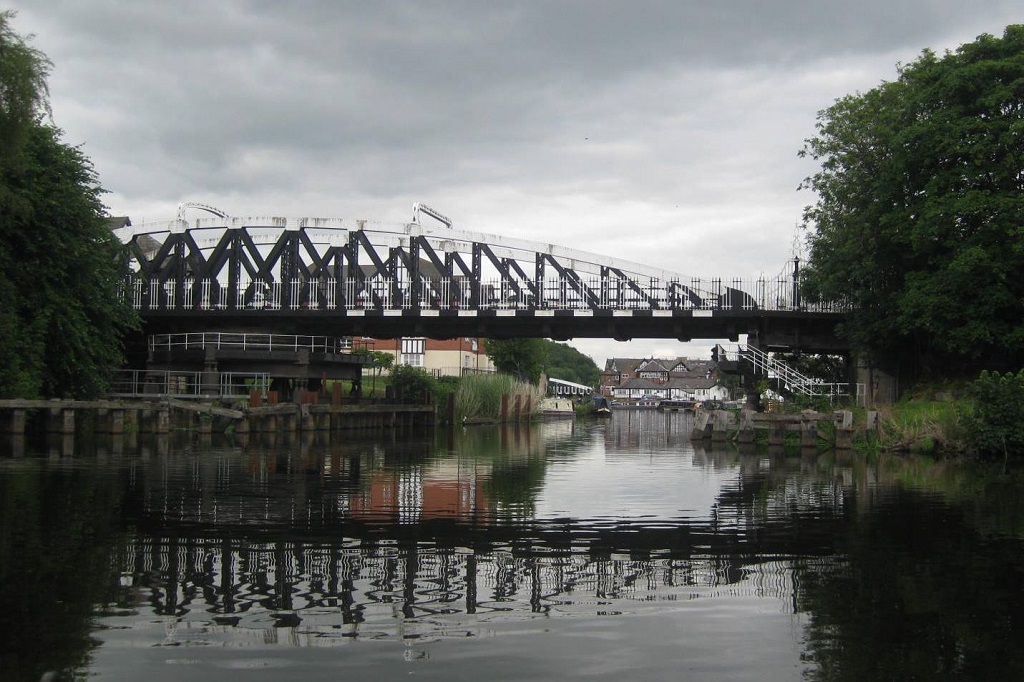
The two swing bridges in Northwich, now 120 years old, were the first in Britain to be turned by electricity and are both listed monuments.
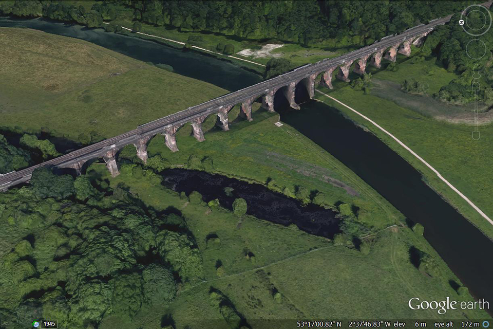
Image from Google Earth
Anyone looking for a walk would do well to visit Vale Royal or Dutton viaducts, both impressive structures built of Cheshire sandstone, carrying the West Coast main line across the Weaver valley.
Acknowledgements: M.J. Hornby, photos not credited provided by Weaverham History Society Archive
